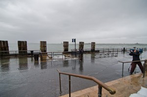
 Hurricane Sandy is a large hurricane that is drowning the East Coast. Many ports along the East Coast have been closed down and areas all along the coast are experiencing high winds, flooding, and even snow.
Whether you’re in the middle of Sandy or know someone who is, keeping track of her is probably near the top of your To Do list. 411US.info can help you keep track of what’s going on in your area.
National & Local Weather
411US.info has several places you can get weather information from. First is the weather display you’ll see after you enter a zip code in the top left portion of the center area. This will give you quick details on the highs, lows, and forecasts of today and the upcoming days.
![]() At the bottom of that weather display is a link you can use to get a more detailed weather report. In this weather report you’ll get:
At the bottom of that weather display is a link you can use to get a more detailed weather report. In this weather report you’ll get:
- Detailed forecast for today
- Tonight’s forecast
- Temperature forecast
- Interactive radar map displaying precipitation for your area
At the top of the page you’ll also see any important warnings for your area as well as recent news stories on the storm.
Another way to track Hurricane Sandy is with the Weather link under the Local Menu. This will take you to another weather site with a 48 hour detailed weather report. At the top it will alert you to any Weather Alerts in your area.
![]() Beneath the 48 hour detailed weather report, you’ll see links to several different maps, including a satellite map of your region.
Beneath the 48 hour detailed weather report, you’ll see links to several different maps, including a satellite map of your region.
Between the satellite map on this site and the precipitation map from the previous site, you can start seeing how Sandy is forming around your area.
Check out some of the other maps on this site for a broader view of what Sandy is doing.
![]() Yet another way to see what Sandy is doing is to look under the National Information menu. Hovering over weather will bring up a list of weather sites. Going to the link for the National Weather Service will bring up a very interesting map.
Yet another way to see what Sandy is doing is to look under the National Information menu. Hovering over weather will bring up a list of weather sites. Going to the link for the National Weather Service will bring up a very interesting map.
This map shows where various weather warnings are located on a national scale. You can click into the map to zoom in on your particular area.
![]() Once you’ve zoomed in you’ll have several choices. You can either zoom in closer to a particular large city, click on a warning link on the right to read the latest weather warnings, or check out some of the maps linked to at the bottom.
Once you’ve zoomed in you’ll have several choices. You can either zoom in closer to a particular large city, click on a warning link on the right to read the latest weather warnings, or check out some of the maps linked to at the bottom.
These warnings will be specific to the area you’re investigated and will advise you to take certain precautions. They are similar to the warnings you will receive on your local radio and TV stations.
With all of these ways to keep tabs on Sandy you should be able to move to a safe location and know when to brace for the worst parts of your storm. Be careful these next few days and stay tuned to your local information.
Top Image: dsgray16


